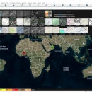
HTZ communications
RADIO NETWORK PLANNING - ATDI
WHAT IS HTZ communications?
HTZ communications is ATDI’s flagship RF engineering software. This new edition of world leading RF design and spectrum engineering solution includes several grounbreaking features such as AUTOMATIC RADIO NETWORK PLANNING, GIS ENGINE WHICH ENABLES to CREATE HIGH RESOLUTION building information in raster from Digital Surface Model – DSM samples.
HTZ communications replaces ICS telecom EV.
HTZ communications is the ideal tool for PLANNING HOMOGENEOUS AND HETEROGENEOUS WIRELESS NETWORKS.
HTZ communications is the solution of choice for designing spectrum-dependent communication systems such a Cellular Networks (2G, 3G, 4G, 5G), PMR, Broadband technologies, BROADCASTING, IoT, SATELLITE, RADARS, etc.
HTZ communications is continuously EVOLVING to enrich its features and to introduce support for emerging technologies.
HTZ communications can be deployed on standalone computers or in a NETWORK ENVIRONMENT with flexible licensing options.
PERFORMANCES OF HTZ communications
Automatic Coverage Calculation
The resource intensive process of repetitive and regular network studies is the thing of the past with HTZ communications. These processes can be fully automated and free up the valuable resources to perform other tasks and activities. The automation feature includes GIS data importation from generic GIS formats such as GeoTiff. This is of particular interest for operations where the environment is constantly changing such as those in Open mine environments where the terrain profile is changing on almost daily basis.
The automation engine automatically calculates coverage of individual sites, and then, produce composite coverage, and identify best servers, study overlaps, calculate C/N+I map in dB. For 4G and 5G networks, it also automatically calculates SINR and throughput maps.
For Microwave transmission networks, the automatic microwave path calculation engine sends an email notification if minimum clearance requirement is not met.
All the study results are exported in KMZ and TIF/TFW files and are delivered to a display system in the operations center.
FUNCTIONS OF HTZ communications
NETWORK PLANNING AND ANALYSES
HTZ communications is a proven radio planning solution with its high accuracy in RF propagation modelling and prediction.
Prospective planning to identify the best locations for new sites for greenfield and densification scenarios
Migration analysis from analogue to digital communications
Analysis of outdoor to indoor coverage by signal penetration loss calculation
Population analysis according to points, areas by vector polygon importation or raster files
In-depth coverage study of network coverage, composite coverage, overlapping, best server and network densification
Propagation model tuning by correlation analysis between prediction and measurement
Automated frequency assignment and optimization
Traffic analysis by the ground occupancy, target areas or mesh blocks to cover
Point to Point network analysis: Path profile, Reliability, Automatic optimization, frequency and space diversity, frequency analysis
Simulcast planning and analysis
EMF
PUBLIC SAFETY NETWORK / PPDR
HTZ communications supports designing and modelling of TETRA, PMR/DMR, P25 and PS- LTE with the ability to manage coverage, capacity, site parameters and neighbour planning and optimization.
It ensures the highest level of reliability, availability and resilience of critical comms and assist operators to achieve smooth migration to broadband connectivity and new technologies.
Coverage planning
Interference calculations
Capacity planning
Automated handover, neighbor list planning and analysis
Monte Carlo simulations
Automatic site planning
Automatic site optimization
Automatic frequency planning
Traffic & mobility profile editor (end devices)
UAV / UAS MISSION PLANNING
HTZ communications is the perfect choice for UAV/UAS comes network, which often required to integrate ground-to-air, air-to-air services and complex scenarios of compatibility with other civilian/military communication services.
Aeronautical propagation model ITU-R P. 528
Frequency planning and interference analysis along the way points
Self-healing network planning using mesh technique
Path specific way points coverage and optimization on fly path to overcome connectivity issues
Radar detection avoidance planning by optimization of flying path and altitude optimization
Calculate interference level due to terrestrial networks directly impacting such drones along flight-path
Instantaneous roll, pitch and course modelling; antenna orientation calculation, antenna discrimination along the flying path
MARITIME COMMUNICATION
HTZ communications supports any communications between sea to sea, sea to air and land to sea communication in maritime communications.
The complex scenarios of coverage, interference and intermodulation impact within battleships/ships environment can be examined and simulated to ensure the radio systems in the same vessel are performing effectively and efficiently.
Near-field scenarios in Battleship: HF/VHF/UHF, radar, satellite systems intermodulation analysis
Location optimisation of new radio systems against existing radios on board
3D modelling of Battleships/Ships from AutoCAD, ESRI Shape and PDF drawing
Interference analysis against terrestrial radios against satellite earth stations to identify exclusion zones
HTZ communications current version: V22.6.8 (07-2020)HTZ communications replaces ICS telecom EV (HTZ subset)(c) 1988-2020